
Dr Gary Hunter from Australia recently spent three months in Zimbabwe assisting medium-sized local authorities to implement Geographic information Systems (GIS). Following his successful six-month deployment with the City of Bulawayo in 2014 on behalf of Australian Aid and GIZ, in 2015 he was supported by GIZ to return to Zimbabwe to work with the local authorities in the towns of Gweru, Kadoma, Chinhoyi and Kariba.
Following initial assessments of the capacity of the councils to maintain their own independent GIS mapping sections, 26 council staff were trained in GIS in Harare and computer equipment was procured for each of the councils. A highlight of the training program was the presentation by Mrs Sibusisiwe Sibanda, GIS Officer at the City of Bulawayo who worked with Dr Hunter in 2014, who gave examples of the benefits of GIS for local government.
Dr Hunter spent several weeks with each council installing the GIS equipment and mentoring the staff in its use. Council staff were keen to use the new technology and their enthusiasm for GIS was best expressed by the Assistant Director of Engineering Services at Kariba, Eng. Gangata, when he stated “It is long overdue.”
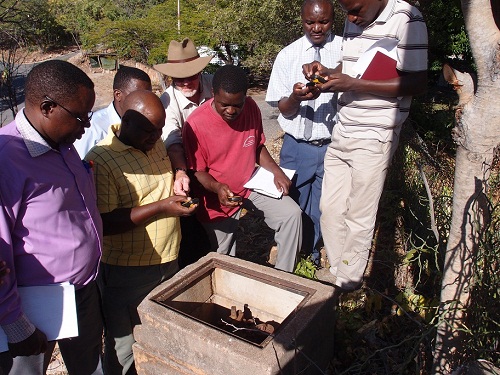
“Dr Hunter instructs technical staff at the Municipality of Kariba to use their new GPS equipment to map fire hydrants”